Decision-making today relies on data more than instinct. Whether in city planning, environmental monitoring, or business expansion, leaders need spatial insights to reduce risks and improve outcomes. That’s why organizations increasingly turn to GIS Services Company Solutions to translate complex data into clear maps that support smart choices. Mapping in GIS Services provides a framework to visualize patterns, forecast trends, and connect decisions to real-world impacts.
Mapping in GIS Services
- Turning data into insights: Mapping in GIS Services translates raw datasets into location-based intelligence, enabling faster, evidence-driven decisions.
- Layered perspectives: Combining spatial layers, such as land use, population density, and traffic flow, creates a holistic view for planning and problem-solving.
- Cross-industry value: From healthcare optimizing ambulance routes to logistics streamlining delivery paths, GIS maps help reduce costs and improve real-world outcomes.
- Avoiding common mistakes: Pitfalls often include relying on outdated data, underestimating the need for staff training, and over-emphasizing visuals without context or validation.
- Future-ready tools: Cloud-based platforms and AI-powered enhancements are shaping the next generation of GIS mapping, improving scalability, accuracy, and predictive power.
What Is Mapping in GIS Services?
Mapping in GIS Services refers to the process of collecting, analyzing, and visualizing spatial data to support decision-making. Unlike static maps, GIS maps are dynamic. They can overlay multiple data layers, update in real time, and allow interactive exploration.
For example, a public health team might map disease outbreaks against hospital locations, transportation routes, and population density to predict resource needs. The value lies not just in the map itself but in the ability to analyze “where” and “why” questions simultaneously.
How Mapping in GIS Services Works Step by Step
- Data Collection
- Sources: satellite imagery, field surveys, IoT sensors, open government datasets.
- Example: A city gathers traffic counts from sensors installed at intersections.
- Sources: satellite imagery, field surveys, IoT sensors, open government datasets.
- Data Integration
- Different datasets are combined into one system.
- Example: Traffic data layered with land use and weather patterns.
- Different datasets are combined into one system.
- Spatial Analysis
- Algorithms identify trends and correlations.
- Example: Pinpointing which roads are congested only during rain.
- Algorithms identify trends and correlations.
- Visualization
- Maps display data with color codes, symbols, or heatmaps.
- Example: Red zones highlight areas where flood risk intersects with high population density.
- Maps display data with color codes, symbols, or heatmaps.
- Decision-Making
- Leaders use these maps to allocate resources or approve projects.
- Example: A local council prioritizes storm drain upgrades in the highest-risk neighborhoods.
- Leaders use these maps to allocate resources or approve projects.
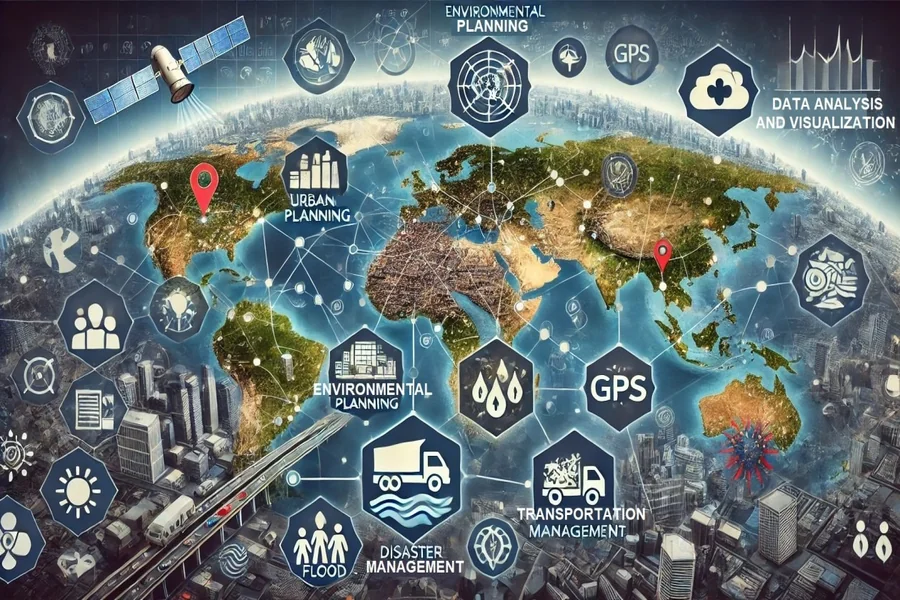
Practical Applications of Mapping in GIS Services
- Urban Planning
Zoning, utilities, and housing expansion are modeled through interactive maps. In 2024, the U.S. Census Bureau reported that 83% of the population lives in urban areas, making such mapping essential for growth management.
- Disaster Management
Real-time flood and wildfire maps help agencies allocate rescue resources.
- Environmental Monitoring
Forest cover change and air quality levels are tracked through layered mapping.
- Business Development
Retail chains analyze foot traffic, competition, and demographics before opening new stores.
- Healthcare
Mapping patient access to clinics highlights underserved regions, improving equity in healthcare delivery.
Tools for Mapping in GIS Services
| Tool/Platform | Best For | Strengths | Limitations |
| ArcGIS | Enterprise-level mapping | Extensive tools, strong community support | Costly licenses |
| QGIS | Open-source alternative | Free, flexible, strong plugin ecosystem | Steeper learning curve |
| Google Earth Engine | Environmental data analysis | Massive datasets, cloud-based | Requires coding knowledge |
| Mapbox | Custom web maps | High customization, developer-friendly | Limited offline use |
| GRASS GIS | Scientific research | Advanced modeling and spatial analysis | Complex interface |
Pros and Cons of Using Mapping in GIS Services
Mapping is one of the most recognizable and widely applied functions of GIS. While it offers undeniable advantages for organizations, it also presents certain challenges that professionals must manage carefully.
Pros of Mapping in GIS Services
- Integrates multiple data types for comprehensive insight
GIS mapping can combine demographic data, topography, infrastructure layers, and environmental metrics into a single platform. This integration allows decision-makers to see connections that would remain hidden in spreadsheets or siloed reports.
-
Provides real-time visualization for fast responses
In fields like disaster management or traffic monitoring, GIS maps update in real time. For instance, emergency services can track storm movement or road closures as they happen, enabling quicker responses that save time and resources.
-
Enhances collaboration across teams through shared maps
Cloud-based GIS mapping tools let planners, engineers, and policymakers view and edit the same datasets. This shared access reduces miscommunication and ensures everyone works with consistent information.
-
Supports scenario modeling and predictive planning
Maps aren’t just static visuals; they can simulate “what-if” scenarios, such as future population growth or environmental change. This makes them a powerful tool for strategic planning.
Cons of Mapping in GIS Services
-
Requires staff training to interpret results correctly
Sophisticated GIS maps often involve layers, symbology, and statistical outputs that are not intuitive. Without adequate training, users may misinterpret patterns or overlook critical details.
-
High licensing costs for enterprise software
Industry-grade platforms like ArcGIS can be expensive to license and maintain, particularly for smaller organizations. While open-source tools exist, they may lack certain advanced features or dedicated support.
-
Data accuracy can vary, which can impact decisions
If input data is outdated, incomplete, or collected at inconsistent scales, the resulting maps may mislead rather than inform. Decision-makers must always verify data quality before relying on map outputs.
-
Technology dependence and maintenance needs
GIS mapping relies heavily on stable infrastructure, regular software updates, and compatible hardware. Breakdowns or delays in updates can slow down critical workflows.
Common Mistakes to Avoid in GIS Analysis
Even advanced practitioners can fall into traps that reduce the reliability of their results. Recognizing these pitfalls helps ensure that analysis delivers real value rather than misleading conclusions.
1. Relying on Outdated Data
Using a 2019 dataset for 2025 decisions risks misalignment with current realities. Urban landscapes, population trends, and environmental conditions change quickly. Always check metadata for the date of collection and update data sources regularly.
2. Over-Visualizing Without Purpose
Adding too many map layers can overwhelm decision-makers. A cluttered visualization hides insights instead of highlighting them. Effective GIS analysis prioritizes clarity: only display layers that directly support the decision at hand.
3. Ignoring Non-Spatial Context
Spatial data rarely tells the full story. Demographic shifts, economic activity, or policy changes may carry equal weight. For example, a flood-risk map without household income data misses how vulnerable communities might be affected differently.
4. Lack of Stakeholder Input
Maps and models are powerful, but they cannot replace local knowledge. Excluding input from community members, field engineers, or policy stakeholders often leads to solutions that fail in practice. Integrating feedback grounds GIS analysis in lived reality.
5. Misinterpreting Scale
A pattern that appears at the city level may disappear when zoomed into neighborhoods. Analysts sometimes generalize results across scales without testing. Always validate whether insights hold true at multiple levels.
6. Skipping Model Validation
Predictive GIS models—such as those projecting traffic or flood zones, must be tested against actual events. Without validation, predictions remain speculative and may mislead planners.
FAQs
- How is mapping in GIS services different from traditional mapping?
Traditional maps are static, while GIS maps are interactive, layered, and data-driven. - Which industries benefit most from mapping in GIS services?
Urban planning, logistics, healthcare, environmental monitoring, and utilities. - Is mapping in GIS services expensive?
Costs vary. Open-source options, such as QGIS, are free, whereas enterprise tools like ArcGIS require licenses. - Can small businesses use GIS mapping effectively?
Yes. Even basic mapping can help small retailers identify customer hotspots or delivery zones. - What future trends are shaping GIS mapping?
AI integration, cloud-based collaboration, and 3D/VR visualizations. - How accurate is GIS mapping?
Accuracy depends on data sources. High-resolution satellite imagery and real-time sensors improve reliability.
The Future of Analysis in GIS
Mapping in GIS services has moved far beyond its early role as a specialist tool for cartographers. Today, it functions as a central resource for decision-making across industries. Leaders who embrace advanced analysis in GIS can anticipate risks more effectively, allocate resources with precision, and craft strategies that reflect real-world conditions.
The shift toward cloud platforms and AI-driven enhancements is accelerating this transformation. Cloud-based GIS reduces barriers to entry by making large-scale datasets accessible in real time, while AI-powered models enable predictive analysis that was once limited to research labs. These advancements mean spatial decision-making is no longer optional; it’s becoming a fundamental requirement for organizations that want to stay competitive.
In practice, this means city planners can design more resilient infrastructure, supply chain managers can anticipate disruptions before they occur, and environmental agencies can track changes with unprecedented accuracy. The message is clear: adopting GIS analysis is no longer about gaining an edge; it’s about keeping pace with a world where location intelligence is at the heart of strategic action.